Destinations › South America · The Destination Index · recorded destination information · verify source dates and scope

Guyana.

Northern South America on the Atlantic coast, between Venezuela, Brazil and Suriname. 211,140 sq km of land, 87.09% of it forest, and 878,674 people almost all living on the coastal plain.
Region · South America Population · 878,674 at the 2022 Census (Bureau of Statistics, Guyana). The World Bank estimates 835,986 for 2025. Both are given because the national census and the World Bank series do not agree. Languages · English is the official language. Guyanese Creole is widely spoken, alongside Indigenous languages including Akawaio, Macushi, Wapishana and Warrau. Eco Index · current assessment unavailable
87.09% forest cover · 878,674 residents at the 2022 Census

Recorded destination information: check source dates and scope below. A recorded statement is not a current independently reviewed assessment. Current scores and rankings remain unavailable.

Assessment status

Current destination assessment unavailable. Historical indicators require current source and method verification before a score or ranking is published.

The History of Guyana.

Nine Indigenous Nations were here first and all nine remain. The colonial layer is Dutch then British, the plantation economy brought enslaved Africans and then indentured Indians, and independence came in 1966. The forest outlasted all of it.
Where the name comes from
The name comes from an Indigenous term for land of many waters, which the hydrology bears out: 293,317 cubic metres of renewable internal freshwater per person (World Bank, 2022).
Northern South America on the Atlantic coast, between Venezuela, Brazil and Suriname. 211,140 sq km of land (World Bank, 2023), most of it forest, with the population concentrated on a narrow coastal plain.
The timeline
Before 1500
The nine nations.
Nine Indigenous Nations settled across what are now the ten administrative regions: Arawak (Lokono), Arecuna, Akawaio, Carib, Macushi, Patamona, Wai Wai, Wapichan and Warrau. All nine remain today, and 96 villages hold legal title to the land they occupy, out of 212 villages and communities. ↗
26 May 1966
Independence.
British Guiana becomes independent Guyana, the only English speaking country in South America. Forbes Burnham and Cheddi Jagan, whose families reached the colony by slavery and by indenture, stood together at the ceremony. ↗
2018
A forest policy for 87% forest cover.
Guyana adopts a revised National Forest Policy Statement, setting the terms for a country where forest still covers 87.09% of the land. The policy governs a forest estate larger than the settled coast that most Guyanese actually live on. ↗
1881 to 1905
The working people.
The generation after emancipation and indenture is the subject of the standard account of Guyanese social history, written by the Guyanese historian Walter Rodney: a working people formed on the sugar estates and in the villages, African and Indian, whose organisation shaped the country that followed. ↗

Nature and Biodiversity in Guyana.

Forest covers 87.09% of the land (World Bank, 2023), one of the highest shares of any country. Protected areas cover 8.4% of land and none of the sea (World Bank, 2025), so the protection is mostly the forest itself rather than the reserve network.
Nature
How protected is nature in Guyana?
Forest cover87.09%
Terrestrial protected area8.4%
Marine protected area0%
22 listed as threatened.
Species to know
Recorded in Guyana and named in the open record. Endemic status is stated per species, not implied by this list.
Carollia perspicillata
Common short-tailed bat. Recorded in Guyana in specimen-backed records held by GBIF.
Ca
Artibeus lituratus
Great fruit-eating bat. Recorded in Guyana in specimen-backed records held by GBIF.
Ar
Glossophaga longirostris
Greater long-tongued bat. Recorded in Guyana in specimen-backed records held by GBIF.
Gl
Recorded in Guyana and named in the open record via GBIF, from specimen-backed records. Endemic status is stated per species, not implied by this list.
Who is putting it back
Protected area mapped and named in the open record.
Scenic view of fog-covered forests and lakes in Isle Royale National Park, Michigan.
Community owned conservation area mapped and named in the open record.

Water and Ocean in Guyana.

293,317 cubic metres of renewable internal freshwater per person, with 0.6% withdrawn (World Bank, 2022). Abundance is not the problem. Access is: 67.17% of people are on safely managed drinking water (World Bank, 2024).
Water
Rivers and groundwater. 67.17% of people are on safely managed drinking water (World Bank, 2024) despite 293,317 cubic metres per person of renewable resources.
How much fresh water does Guyana have, per person?
293,317 m³
Guyana
1,000 m³
the UN “water scarce” line
Withdrawals take 3.3% of renewable resources (World Bank, 2022), so the constraint is treatment and distribution rather than supply.
How hard is the water supply being pushed?
Of every 10 buckets nature refills, 0 are already taken.
How much fresh water does Guyana actually have?
Among the highest renewable freshwater per person of any country, at 293,317 cubic metres (World Bank, 2022).

Food and Drink in Guyana.

The crop base is rice and sugar. Agriculture is 7.73% of GDP and 12.21% of employment (World Bank, 2025) on 0.46% arable land. Adult overweight is 56.42% (World Bank, 2022), which is the imported processed half of the diet showing up.
Where does the food in Guyana come from?
6.5% imported
On the plate: Rice, sugar, cassava, plantain
How often each food is on the plate
Share of people eating each one regularly. These overlap, so they do not add up to 100%.
Rice70%
Cassava40%
Plantain35%
1 of 10
bites are imported
The island buys in more food energy than it eats. The green slice is roughly what still grows here.
What is killing people in Guyana? The imported diet.
Cause of death, and the diet behind it.
Non-communicable diseases, all combined47.21%
Diabetes16.4%
Adults living with overweight or obesity. 56.4%.
Can Guyana feed itself?
0.5%
Arable land
3.4%
Agricultural land
7.7%
Agriculture, share of GDP
Harvest: Two rice crops a year on the coastal plain
Almost no arable land
Only 0.46% of the country is arable and 3.41% is agricultural land (World Bank, 2023). Farming is squeezed onto the coast.
Two crops
Rice and sugar dominate. Agriculture is 7.73% of GDP and 12.21% of employment (World Bank, 2025).
Organic is unmeasured
No national certified organic farmland figure is published, so the sector cannot be scored on evidence.
Why the organic number looks like that. Guyana publishes no national certified organic farmland figure, so the organic sector is not measured rather than absent.

Climate and Energy in Guyana.

Renewables supplied 7.11% of electricity in 2021, with 92.89% from fossil fuels (World Bank), and 93% of people have access to electricity (World Bank, 2024). Renewables reach 12.1% of total final energy consumption (World Bank, 2022).
What powers Guyana?
Renewable 7.1%Fossil 92.9%
Climate pollution per person
The safe amount, what the planet can absorb
2 tonnes
One person here
4.56 tonnes
The world average, for comparison
4.69 tonnes
The grid
Renewables were 7.11% of electricity in 2021 against 92.89% fossil (World Bank), in a country that has just become an offshore oil producer.
Waste
Open burning and open dumping are still the main disposal routes, with the Haags Bosch landfill taking around 110,000 tonnes a year.
The coast
26.49% of people are urban (World Bank, 2025) and the population is concentrated on a low coastal plain, while 87.09% of the land behind it is forest.
What pollutes most here
Electricity generation
Open burning of waste
Offshore oil

AI and Data Centres in Guyana.

Every prompt runs on a machine in a building on somebody’s grid. What that costs the planet depends less on the prompt than on what is burning to power it. Here is what would power one in Guyana.
Grid renewable
7.1 %
What a machine here runs on.
What powers a data centre in Guyana?
Almost everything a machine here consumes is burned fossil fuel.
Renewable 7.1%Fossil 92.9%

Economy and Tourism in Guyana.

878,674 residents at the 2022 Census (Bureau of Statistics, Guyana), most of them on the coastal strip rather than in the forest that covers the rest.
Economy and tourism
86k
Visitors a year
GDPUS$27.1 bn (2025)
Agriculture, forestry and fishing7.73% of GDP (2025)
Employment in agriculture12.21% (2025)
Renewable electricity7.11% (2021)
Forest
87.09% of the land is forest (World Bank, 2023), governed under the 2018 National Forest Policy Statement.
Agriculture
Rice and sugar on 0.46% arable land, 7.73% of GDP (World Bank, 2025).
Oil
GDP reached US$27.1 billion in 2025 (World Bank), transformed by offshore production, while renewable electricity stayed at 7.11%.

Visiting Guyana, whoever you are.

Resort guest, villa renter, family, nomad or backpacker. The honest playbook for each, from the same sourced numbers.
Already booked a resort? · the rescue list
Five swaps that move your money back on-island
1. Eat what the coast grows Rice is the staple crop here and agriculture employs 12.21% of the workforce. Eat the crop base rather than the imported half that shows up in a 56.42% adult overweight rate.
2. Book through the village 96 Amerindian villages hold legal title to their land. Where a community owns the land, the money can stay on it.
3. Carry your waste out Formal recycling is minimal and most waste is burned or dumped. What you bring in, take out.
4. Ask about the grid 7.11% of electricity is renewable. A lodge running on its own solar is doing something the national grid is not.
swipe →
First time here
Guyana is 87.09% forest with a population of 878,674, almost all on the coast. The interior is reached by light aircraft and river, not road.
Best time: the drier months
Nature first
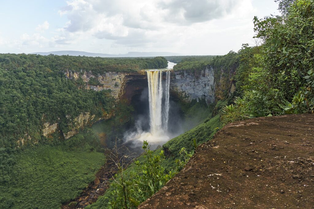
Kaieteur National Park, the Iwokrama Wilderness Reserve and the Kanuku Mountains Protected Area are all named and mapped in the open record.
Protected land is 8.4%
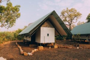
Charming cabin nestled in the natural Australian landscape, perfect for a peaceful retreat.
Staying responsibly
Kanashen is a community owned conservation area, and 96 Amerindian villages hold title to their land. Book through the village, not around it.
The fare either stays or leaves

Society and Governance in Guyana.

Society
878,674 people at the 2022 Census, 26.49% of them urban (World Bank, 2025). Adult literacy is 85.64% (World Bank, 2020) and life expectancy 70.32 years (World Bank, 2024). 93% have access to electricity (World Bank, 2024).
What is daily life in Guyana really like? Measured
Getting around, breathing, throwing away, learning. The honest checklist.
AirWaterEnergyWasteNatureCulture
✓Air quality, measured Mean annual PM2.5 is 16.95 ug/m3 (World Bank, 2023).
85.6%
literacy.

Culture in Guyana.

September
Amerindian Heritage Month
A month of events run with the Ministry of Amerindian Affairs, including an interfaith service, a food and craft exhibition, a cultural extravaganza, a village heritage day and a heritage dinner, plus language preservation work.
September
Indigenous Heritage Village Day
Village level celebrations across the ten administrative regions, held in the 96 titled Amerindian villages and the wider 212 villages and communities.
Does Guyana protect its heritage by law?
Partly, and the gaps say as much as the protections.
What is kept alive. Nine Indigenous Nations, all still present: Arawak (Lokono), Arecuna, Akawaio, Carib, Macushi, Patamona, Wai Wai, Wapichan and Warrau.
Who it belongs to. 96 villages hold legal title to the land they occupy, out of 212 villages and communities (Ministry of Amerindian Affairs).
What is not recognised. Guyana has no UNESCO World Heritage sites and no inscribed intangible heritage, because it is not party to the 2003 Convention.

The Future of Guyana.

Three futures for Guyana, every one run forward from measured data.
Every measured trend on one line
Run forward at the pace already recorded.
-8%
Forest cover
1990: 94.5% → 2023: 87.09%
1990202387.1%
+60%
Renewable electricity
2000: 4.45% → 2021: 7.11%
200020217.1%
+113%
CO2 per person
1970: 2.14 t → 2024: 4.56 t
197020244.6 t
-3%
Protected land
2013: 8.7% → 2025: 8.4%
201320258.4%
+7%
Safely managed drinking water
2000: 62.74% → 2024: 67.17%
2000202467.2%
-29%
PM2.5 air pollution
1990: 23.72 ug/m3 → 2023: 16.95 ug/m3
1990202316.9 ug/m3
-51%
Agricultural land
1961: 6.91% → 2023: 3.41%
196120233.4%
-9%
Urban population
1960: 29.02% → 2025: 26.49%
1960202526.5%
+22%
Life expectancy
1960: 57.51 yrs → 2024: 70.32 yrs
1960202470.3 yrs
+28%
Access to electricity
1993: 72.38% → 2024: 93%
1993202493%
-69%
Employment in agriculture
1991: 38.82% → 2025: 12.21%
1991202512.2%
-67%
Agriculture share of GDP
1960: 23.58% → 2025: 7.73%
196020257.7%
+47%
Population
1960: 569143 → 2025: 835986
19602025835,986
from zero
Internet use
1990: 0% → 2024: 83.0%
1990202483%
-2%
Diabetes
2011: 16.7 % of adults → 2024: 16.4 % of adults
2011202416.4 % of adults
-29%
Freshwater per person
1961: 413685.61 m3 → 2022: 293316.88 m3
19612022293,316.9 m3
4
How much forest is left?
1990202387.1%
Forest cover moved from 94.5% to 87.09% across 33 recorded years.
World Bank AG.LND.FRST.ZS
How clean is the grid?
200020217.1%
Renewable electricity moved from 4.45% to 7.11% across 21 recorded years.
World Bank EG.ELC.RNEW.ZS
How much climate pollution per person?
197020244.6 t
CO2 per person moved from 2.14 t to 4.56 t across 54 recorded years.
World Bank EN.GHG.CO2.PC.CE.AR5
How much land is protected?
201320258.4%
Protected land moved from 8.7% to 8.4% across 12 recorded years.
World Bank ER.LND.PTLD.ZS
Can people drink the water?
2000202467.2%
Safely managed drinking water moved from 62.74% to 67.17% across 24 recorded years.
World Bank SH.H2O.SMDW.ZS
How clean is the air?
1990202316.9 ug/m3
PM2.5 air pollution moved from 23.72 ug/m3 to 16.95 ug/m3 across 33 recorded years.
World Bank EN.ATM.PM25.MC.M3
How much land is farmed?
196120233.4%
Agricultural land moved from 6.91% to 3.41% across 62 recorded years.
World Bank AG.LND.AGRI.ZS
How urban is it?
1960202526.5%
Urban population moved from 29.02% to 26.49% across 65 recorded years.
World Bank SP.URB.TOTL.IN.ZS
How long do people live?
1960202470.3 yrs
Life expectancy moved from 57.51 yrs to 70.32 yrs across 64 recorded years.
World Bank SP.DYN.LE00.IN
Does everyone have power?
1993202493%
Access to electricity moved from 72.38% to 93% across 31 recorded years.
World Bank EG.ELC.ACCS.ZS
How many people farm?
1991202512.2%
Employment in agriculture moved from 38.82% to 12.21% across 34 recorded years.
World Bank SL.AGR.EMPL.ZS
How much of the economy is farming?
196020257.7%
Agriculture share of GDP moved from 23.58% to 7.73% across 65 recorded years.
World Bank NV.AGR.TOTL.ZS
How many people?
19602025835,986
Population moved from 569143 to 835986 across 65 recorded years.
World Bank SP.POP.TOTL
Who is online?
1990202483%
Internet use moved from 0% to 83.0% across 34 recorded years.
World Bank IT.NET.USER.ZS
How common is diabetes?
2011202416.4 % of adults
Diabetes moved from 16.7 % of adults to 16.4 % of adults across 13 recorded years.
World Bank SH.STA.DIAB.ZS
How much water is there?
19612022293,316.9 m3
Freshwater per person moved from 413685.61 m3 to 293316.88 m3 across 61 recorded years.
World Bank ER.H2O.INTR.PC
Worst caseCurrent pathBest case
Worst case
The worst case is the forest following the oil. 87.09% cover is the single largest thing Guyana has, and it is the one asset that a fossil-funded build-out could spend.
Computed from: Worst case holds the weak pillars where they are and assumes the strong ones erode.
What the best case actually asks for
Lift energy
It scores 1 out of 5 today, the joint weakest pillar.
measured each year
Costs: capital and grid policy, not new technology
Lift recycling
It scores 1 out of 5 today, the joint weakest pillar.
measured each year
Costs: spending and enforcement
Protect the sea
Marine protection is 0%, against a 30% pledge for 2030.
by 2030
Costs: fishing and offshore licensing

Government and Goals in Guyana.

Who is in charge of Guyana now · Office-holders from the UN Protocol and Liaison Service public list of Heads of State and Heads of Government, 8 September 2026. Legislature and election dates from IFES ElectionGuide. Constitution dates from the Constitute Project. Governance scores from the World Bank Worldwide Governance Indicators 2024.
Mohamed Irfaan Ali
President
Mohamed Irfaan Ali is the head of government of Guyana, in office since 2 August 2020. Every climate, protection and energy pledge on this page is delivered, or not, under this administration.
Mohamed Irfaan AliPresident
Mark PhillipsPrime Minister
National AssemblyLegislature, unicameral
Last election1 September 2025
Constitution1980, as revised to 2016
Government typepresidential republic within the Commonwealth
Guyana national goals: What the government has signed up to · Targets are from the Kunming-Montreal Global Biodiversity Framework, which Guyana is party to. Status is measured against the World Bank protected-area series on this page.
2030
30% of land protected
far behind
Target 3 of the Kunming-Montreal Global Biodiversity Framework. Guyana currently protects 8.4% of its land (World Bank, 2025). ↗
2030
30% of sea protected
not started
The marine half of the same 30x30 pledge. Guyana currently protects 0% of its territorial waters (World Bank, 2025). ↗
2030
Restore degraded ecosystems
strong base
Target 2 of the same framework. Guyana starts from 87.09% forest cover (World Bank, 2023), so the task is holding ground rather than restoring it. ↗
2018
A national forest policy
adopted
Guyana adopted a revised National Forest Policy Statement in 2018, governing the forest estate that covers most of the country. ↗

Score comparison

Current destination assessment unavailable. Historical indicators require current source and method verification before a score or ranking is published.

The Guyana Directory.

Everything on Hold The Throne that sits in Guyana, checked and listed.
How the rest of the world scores Guyana
Independent global indices, for calibration.
Forest cover
87.09%
World Bank, 2023.
Protected land
8.4%
World Bank, 2025.
Protected sea
0%
World Bank, 2025.
Renewable electricity
7.11%
World Bank, 2021.
Fossil electricity
92.89%
World Bank, 2021.
CO2 per person
4.56 t
World Bank, 2024.
Freshwater per person
293,317 m3
World Bank, 2022.
Freshwater withdrawn
0.6%
World Bank, 2022.
Safely managed drinking water
67.17%
World Bank, 2024.
PM2.5
16.95 ug/m3
World Bank, 2023.
Agricultural land
3.41%
World Bank, 2023.
Arable land
0.46%
World Bank, 2023.
Agriculture share of GDP
7.73%
World Bank, 2025.
Urban population
26.49%
World Bank, 2025.
Adult literacy
85.64%
World Bank, 2020.
Access to electricity
93%
World Bank, 2024.

How Guyana Is Scored. The Throne Standard.

Every destination on the index is scored the same way, so a 4 in Barbados means exactly what a 4 means in Iceland. No self-declared data and no brochure claims are accepted. Every figure on this page carries its named source and year, and the history on each page names what empire took as plainly as it scores the present.
The 12 pillars every destination is scored on, equally weighted
01
Conservation
Land and sea actually protected, not pledged
02
Wildlife
What survives, what is endemic, what is lost
03
Water
Fresh water per person, and the ocean’s health
04
Food & farming
Whether the place can feed itself
05
Organic & clean
Certified land and pesticide reality
06
Climate & energy
Emissions per person, how the grid is powered
07
Waste
Where the rubbish goes, what comes back
08
Health
What people eat and die of
09
Heritage
Living culture, and what the law keeps standing
10
Ownership
Who owns the economy, how much of a dollar stays
11
Governance
Freedom, honesty, promises kept
12
Future
Measured trends run forward, pledges against pace
What each 0 to 5 pillar score means, in plain words
0
Absent
nothing verifiable exists
1
Failing
measurably going the wrong way
2
Weak
claims outrun delivery
3
Fair
real effort, mixed results
4
Strong
genuinely good, evidence named
5
Leading
world class, and the trend holds
Where the numbers come from.
World Bank logo
FAO logo
UNESCO logo
BirdLife International logo
IUCN logo
UNEP-WCMC logo
WHO/UNICEF Joint Monitoring Programme logo
UN SDG Global Database logo
The institutions above are the ones cited on this page, ranked by how many of its figures they carry. This same sectioned page renders for all 77 scored destinations, each with its own researched history, comparison charts and three-way future. Read the full methodology
Every figure on this page, and where it came from: 51 sources across 20 institutions
World Bank14 FIGURES
  • Population, total SP.POP.TOTL, 2025 (835,986) check
  • Land area (sq. km) AG.LND.TOTL.K2, 2023 check
  • Forest area (% of land area) AG.LND.FRST.ZS, 2023 check
  • Terrestrial protected areas (% of total land area) ER.LND.PTLD.ZS, 2025 check
  • Renewable electricity output (% of total) EG.ELC.RNEW.ZS, 2021 check
  • CO2 emissions (metric tons per capita), 2024 check
  • People using safely managed drinking water services (%), 2024 check
  • Agriculture, forestry and fishing, value added (% of GDP), 2025 check
  • Mean annual PM2.5 exposure EN.ATM.PM25.MC.M3, 2023 check
  • Renewable internal freshwater resources per capita ER.H2O.INTR.PC, 2022 check
  • Annual freshwater withdrawals ER.H2O.FWTL.ZS, 2022 check
  • Threatened species EN.MAM.THRD.NO and EN.BIR.THRD.NO, 2022 check
  • Prevalence of obesity SH.STA.OWAD.ZS, 2022 check
  • Employment in agriculture SL.AGR.EMPL.ZS, 2025 check
World Bank Open Data6 FIGURES
  • Forest area (% of land area), Guyana corroboration check
  • Forest area (% of land area), Guyana corroboration check
  • Forest area (% of land area), Guyana corroboration check
  • Renewable electricity output (% of total electricity output), Guyana corroboration check
  • Renewable electricity output (% of total electricity output), Guyana corroboration check
  • Renewable electricity output (% of total electricity output), Guyana corroboration check
Guyana Lands and Surveys Commission5 FIGURES
  • Fact Page on Guyana, Language Spoken, Guyana is the only English speaking country in South America, and one of the most forested places on Earth. check
  • Fact Page on Guyana, Language Spoken corroboration check
  • Fact Page on Guyana, Language Spoken corroboration check
  • Fact Page on Guyana, Language Spoken corroboration check
  • Fact Page on Guyana, Language Spoken corroboration check
FAO, Global Forest Resources Assessment3 FIGURES
  • UN SDG Global Database, forest area (% of land area) AG_LND_FRST, Guyana, 2025 (93.4%), country-reported check
  • UN SDG Global Database, forest area under a long-term management plan (%) AG_LND_FRSTMGT, Guyana, 2025 (84.4%), country-reported check
  • UN SDG Global Database, forest area inside legally established protected areas (%) AG_LND_FRSTPRCT, Guyana, 2025 (5.9%), country-reported check
Ministry of Amerindian Affairs3 FIGURES
  • Guyana, Indigenous Nations check
  • Guyana, Amerindian Villages (96 titled) check
  • Guyana, Amerindian Heritage check
Parliament of Guyana3 FIGURES
  • History of Parliament, British Guiana becomes independent Guyana, the only English speaking country in South America. check
  • History of Parliament corroboration check
  • History of Parliament corroboration check
BirdLife International, IUCN and UNEP-WCMC2 FIGURES
  • UN SDG Global Database, terrestrial Key Biodiversity Areas covered by protected areas (%) ER_PTD_TERR, Guyana, 2025 (100.0%), country-reported check
  • UN SDG Global Database, freshwater Key Biodiversity Areas covered by protected areas (%) ER_PTD_FRHWTR, Guyana, 2025 (100.0%), country-reported check
UNESCO Legal Affairs2 FIGURES
  • Conventions ratified by Guyana, None of this is inscribed internationally, because Guyana is not a party to the 2003 UNESCO Convention on inta check
  • Conventions ratified by Guyana corroboration check
WHO/UNICEF Joint Monitoring Programme2 FIGURES
  • UN SDG Global Database, population using safely managed drinking water (%) SH_H2O_SAFE, Guyana, 2024 (67.2%), modelled estimate check
  • UN SDG Global Database, population using safely managed sanitation (%) SH_SAN_SAFE, Guyana, 2024 (43.4%), modelled estimate check
Bureau of Statistics1 FIGURE
  • Guyana, Population 878,674 (2022 Census) check
Constitute Project1 FIGURE
  • Guyana 1980 (rev. 2016) check
Environmental Protection Agency Guyana1 FIGURE check
Guyana Bureau of Statistics1 FIGURE check
Guyana Forestry Commission1 FIGURE check
Guyana National Forest Policy Statement 20181 FIGURE
  • Guyana Forestry Commission check
IFES ElectionGuide1 FIGURE
  • Guyana elections and chambers check
Other published sources1 FIGURE
  • Guyana Waste Management and Recycling Infrastructure Assessment, Logistics Cluster check
UN Protocol and Liaison Service1 FIGURE
  • Heads of State, Heads of Government and Ministers for Foreign Affairs, public list dated 8 September 2026 check
UN Statistics Division, Energy Balances1 FIGURE
  • UN SDG Global Database, renewable share of total final energy consumption (%) EG_FEC_RNEW, Guyana, 2024 (8.3%), modelled estimate check
UNESCO1 FIGURE
  • Guyana is not party to the 2003 Convention (no inscribed intangible heritage) check